
This is the fourth day since we landed at Tbilisi, Georgia and our stay has been intense.
Behind us is the first day with the visit to David-Gareji monastery and "touristic face of Georgia" Sighnaghi town. Second day showed us Georgian religious landmarks - Jvari monastery, Svetitskhoveli Cathedral in Mtskheta and cave monastery in Shio-Mgvime, as well Ananuri fortress and mountains of The Greater Caucasus Mountain Range. And now we are on a two-day trip: on our first day we visited the region of Imereti with Stunning murals in Gelati monastery and Prometheus caves near Tskhaltubo. After an overnight in Akhaltsikhe we are ready to see Kvertvisi fortress and the cave city of Vardzia.

A short stop by Kura (Mtkvari) river - just to snap the view.
Behind us is the first day with the visit to David-Gareji monastery and "touristic face of Georgia" Sighnaghi town. Second day showed us Georgian religious landmarks - Jvari monastery, Svetitskhoveli Cathedral in Mtskheta and cave monastery in Shio-Mgvime, as well Ananuri fortress and mountains of The Greater Caucasus Mountain Range. And now we are on a two-day trip: on our first day we visited the region of Imereti with Stunning murals in Gelati monastery and Prometheus caves near Tskhaltubo. After an overnight in Akhaltsikhe we are ready to see Kvertvisi fortress and the cave city of Vardzia.
A short stop by Kura (Mtkvari) river - just to snap the view.

Finally we stop by Khertvisi - one of the oldest fortresses in Georgia.
It is believed that the first fortress was first build here as early as the 2nd century BC and was destroyed by Alexander the Great himself. The thorough excavations were never really conducted so here might very well be found some artifacts from Alexander's times. The present walls were built in the XIV century.
We left the mini-van at the parking below and went up the hill.

The fortress consists of two levels: the citadel and the lower walls occupying much of the hill.
 |
| Group walking along the lower walls |
Once you reach the gate through the lower walls the road takes turn towards the citadel.

The entrance to the citadel is not very evident: look closer to see the arch between the towers. No wonder the gate was not decorated - Khertvisi was not a palace for festivities but a fortress located by the strategic road
Nowadays the military garrisons have left the fortress and the only local inhabitants are cows hiding from the heat in the shade of the towers and walls.

Make sure to climb to the small chapel: from its balcony one can truly appreciate the wisdom of ancient builders. Located in the canyon of Kura Mtkvari river, at the confluence of Kura and Paravani it gives an excellent field of view to the road leading to (and from) major Georgian enemies - Turks.

On the other side you can see the road leading back to Akhaltsikhe and bridge across Paravani river.


As we were walking by the exit cows hiding in the shade did not even turn our heads towards us: these silly tourists bother walking in the head, but for them it is too hot to move.

Time to leave Khertvisi, but as the group is a bit behind we ran farther trying to find a spot for a general view.
To get these view I had to climb up the old gate in the lower wall.


Another way to snap the general view is from near the drawbridge across Kura river.

We even tried walking by the drawbridge in search of a good view but it was way too shaky. I guess, locals do not need to visit adventure parks.

At least, the bridge gives another vantage point to the fortress.

Another view of the fortress opens up from the road to Akhalkalaki, after we visited Vardzia. Make sure you ask the driver to stop as soon as you turn left after the fortress.

An important stop on the way to Vardzia is in Tmogvi. What now looks like a non-remarkable river canyon was once the location of Tmogvi fortress.

Here is the narrowest point of Mtkvari canyon so the fortress was blocking this strategic point on the road from the South, the lands of Seljuk Turks.
What seems just a mountain across the river, still bears the remains of the fortress: walls...
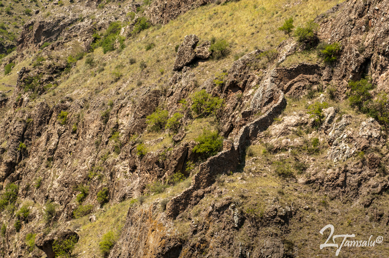
...remains of entrance gate and the towers (try to find them on the picture!).

Soon we stop on the low river bank for the introduction to Vardzia. The cliff across the river is the location of the cave city. The plan of King George III, the father of legendary Queen Tamara who started this ambitious project was that the city would be difficult to spot for the enemies. The Turks would gallop past Vardzia without noticing it, and when they get stuck in the bottleneck by Tmogvi, the troops would come unnoticed from the Vardzia caves and would hit from behind.
It really is hard to notice the city, isn't it?


According to George's plan the city could accommodate up to 30,000 warriors, quite a military strength for those times. In case local citizens needed to run for shelter, it could house as many as 50,000 people.


However this mastermind plan was never put to practice. Georgian military success diminished the threat from Seljuk Turks and the construction of such a military base was no longer a necessity. After the death of George III his daughter Queen Tamar decided to continue the construction but in a different direction: she turned it into Royal monastery.
The caves stretch along the cliff for some five hundred meters and in up to nineteen tiers.

In its prime each Vardzia house had three parts: caves excavated from the slopes served as utility rooms and storerooms, followed by living rooms and large terraced balconies. Built in the XII century, the monastery did not prosper for long: a devastating earthquake of 1283 destroyed most of the city. So what we see now are mostly the utility rooms, there are only few floors of the living rooms left and of course the terraces did not survive...
The twin-storey bell tower (in the picture center) replaced cave dwellings destroyed by the earthquake and now serves as an entrance gate and sort of a starting point of the tours. Here we meet our guide.

The bell tower gives opportunity to enjoy the views of Mtkvari canyon and once again admire the mastership of ancient builders.
 |
| View from the bell tower |
 |
| View from the bell tower |


Hand railings, of course, were not a part of original plan. Remember, what we see now is are only back rooms, one third of the former monastery.

Normally, we are not fans of guides, but must admit touring Vardzia without one you would see and learn so much more than just old rocks and caves.
For example, one of the first caves is former monks refectory. The parallel rocks on both sides are the benches and the tables where monks used to sit and eat facing each other. The order in which they were seated depended on their ranks with the most respected ones strategically positioned closer to the holes in the floor. Guess what these were for? Of course, for wine pitchers. As monks spent most their time in fasting, their bodies needed vitamins and it was mandatory for each of them to take between one and three glasses of red wine a day. The quantity also depended on the monk's rank.

Another hole in the floor - such as below - is an oven for baking bread. The city was absolutely self-sufficient: the excavations revealed bakery, forge, water facilities, ventilation system, cemetery, library, pharmacy...

The central spiritual and monumental focus of the site is the Church of the Dormition. Some unique murals have survived here. Unlike in Gelati monastery where the murals underwent restoration in XVII century, Vardzia murals are originals from the XII century and were never restored.


This is the oldest mural - the remains of the military chapel founded by King George III. In respect to her father's project, Queen Tamar kept this part intact.


Amazingly enough, the Ottoman takeover in the sixteenth century and the cruelty of conquerors rendered a good service to the murals. During the conquest of Georgia the Shahs were determined not only to capture the precious metals, but also to ruin Georgian nation and replace it with Persian ethnicity. Religion is one of the foundations of Georgians so no wonder conquerors made the point to ruin murals, take icons and relics as trophies, kill the monks...
When Ottomans took over Vardzia they wanted to ruin the murals. In order to accomplish this, they collected huge wax candles in the middle of the church and set them on fire. This gesture of vandalism in fact saved the murals: the walls were covered with a layer of carbon-black so it looked like the paintings were destroyed. But when centuries later a Greek enthusiastic monk came to Vardzia and tried to revive monastic life here, he discovered that the murals have survived under the layer of soot.


Some murals are outside, in the arch near the bells.

Is this Queen Tamara herself?

But the real gem are the interior murals. By the way, if you want to photograph inside, it is better to seek approval from the monks. Not that they are going to grab your hands and throw your camera on the floor, but it is just polite. For example as we found out from other travelers you are not allowed to photograph during the service so bear this in mind.
Here is one of the three portrayals of Queen Tamara (portrayed with her father King George III on the right. It is remarkable being her earliest surviving portrait. Unlike on other portraits where she is depicted wearing a crown, here she lacks the ribbon that is the attribute of a married woman and her inscription includes the formula "God grant her a long life", while that of he father does not; this helps date the paintings to between Giorgi's death in 1184 and Tamar's marriage in 1186.

The temple contains frescoes with episodes from the life of Christ occupying the vaults and upper walls in a sequence, starting with the Annunciation and ending with Dormition (corresponds to Assumption in Western culture).

On the rear wall of the sanctuary, behind the altar, are Twelve Church Fathers.

There are paintings even in the door arch.

After the temple we visited a small cave that is usually closed to public with the water oozing out from the rocks. This was the backup source of water for the cave city. Most water was coming from nearby springs located higher in the mountains by a sophisticated pipe system, the water could also be obtained from Mtkvari river. In the case of siege, this spring giving a bucket of water a day would help the monks sustain for awhile (provided they save and distribute it equally). Of course, this unusual spring is called Tamara's tears.
We keep walking by the corridors, tunnels and stairs carved from the rock. Sturdy shoes is a must - just look at these steep steps.


Another look at Mtkvary canyon, Vardzia caves and the bell tower where we started our journey.

The two arches on the right are the Church of Dormition.

The city was self-sufficient and was well supplied not only with water and air, but also with such an important matter as wine. As many as twenty-five wine cellars were discovered here. 185 wine jars sunk into the floor document the importance of viticulture to the monastic economy. One of the giant kvevris (wine pitchers) was found during the excavations. Here it is possible to see how they are made. Due to theit huge size, potter's wheel could not be used. Master kvevri-maker was using special template to keep it symmetrical and advanced it by palm-height bands every other day. Nowadays kvevris are made in the same manner, but the transition between these bands is smoothened. This Vardzia kvevri is more archaic and shows how it was made.

Few remaining floors of the living rooms.

The caves, even though they were used for utility purposes, were nevertheless made in a harmonious way, with niches, arches and decorative bands around them.


The ceilings of the caves are covered with carbon-black. We thought these were the remains of the heating system. Bu this begged a question: how could this cave city be hidden from the enemies if the smoke was coming out from the mountain? The guide explained that the city did not need the heating: summer time it was cooled by the mountain, while winter time the mountain gave back the warmth. Of course, there was never really hot, but neither warriors nor monks need much comfort, do they?
The soot layer comes from the fire that the shepherds made after the monastery was abandoned.


The cave with multiple niches served as pharmacy.

Last climb down...

...and we came out from the other side if the monastery. Gently sloping path takes you back down to the parking lot.
There you can find souvenir stalls, buy cold drinks and visit the bathroom (however we wouldn't recommend it, it is not very clean).

Last stop for the day was at the trout farm by the quick Paravani river. There we stocked up on fresh trout that we later took with us to the restaurant. Another plentiful feast and Georgian wine gave the final chord to this eventful day. On the way back, most of the group was sleeping while Beso was tirelessly navigating bumpy roads of Samtskhe-Javakheti.

After four tiring days we decided to take it easy and spend our fifth day in Tbilisi. After all, during our 4 days in Georgia we saw the city mostly in the dark and from the distance. On our last day we planned the trip to wine-making region of Kakheti.
No comments:
Post a Comment