Showing posts with label Estonia. Show all posts

Sunday, August 5, 2012

Nõmme Jazz Jam Session

Yesterday we landed at Nõmme Jazz – annual jazz festival.

Some names who pitched in the jam session – Larry Price (USA) saxophone - vocals; Arcady Shilkloper (Russia-Germany) on French horn; Ryo Kawasaki (Japan) – guitar; Pauline Jean (Haiti –USA) vocals; Daumants Kalninš (Latvian vunderkind) vocals; Ara Yaralyan (Armenia-Estonia) – on double bass; Vitaly Imereli (Georgia-Gruusia) violin virtuoso; Zhenja Gimer (Russia–Finland) on keyboard......
Larry Price (USA) saxophone
Pauline Jean (Haiti – USA) vocals
Arcady Shilkloper (Germany) on French horn
Ryo Kawasaki (Japan) – guitar & Ara Yaralyan (Armenia-Estonia) on double bass
Pauline Jean (Haiti – USA) vocals
Ryo Kawasaki (Japan) – guitar & Ara Yaralyan (Armenia-Estonia) on double bass
Great names, great jazz – and most amazing Jam session at Nõmme old cinema till 3 AM.

Saturday, July 7, 2012

Koguva village. Muhu island, Estonia.

We spent to fantastic days on Estonian Saaremaa island. On the way back there was one more place we wanted to visit: we heard that Koguva village has retained much of its ancient authentic flavor. Koguva is located on the Western side of Muhu, just a few kilometers from the causeway linking the island with Saaremaa so the detour will not be long and it for sure is worth it.
We left the car on the parking lot (the rest of the village is closed for motorized vehicles) and walked towards the sea. In the port we saw something reminding of carcass of an Indian wigwam or Saami skin tent. 


Soon we understood why this wigwam was here, in port: the wooden sticks are used to stretch and dry traditional fishing net called mõrd - fyke. 

Drying fyke


Mõrd represents a series of concentrating wooden circles with nets forming  cones inserted into each other. After a fish swims in through its wide side and then through the narrow tip it cannot swim out. It can only enter the wide side of the next cone and so forth. We were able to see how mõrd is is intended to work: there were two birds trapped in it and we helped them find their way out.


Traditional wooden boat - no plastic! - and still sails.


Another victim of  fyke - trapped dragonfly
Snacks for the long winter

At Koguva port

At Koguva port

Then we returned to village. It was evening and golden evening light was pouring over Koguva streets with traditional Saaremaan fences made of rocks collected on the fields.

On Koguva streets
The reason that this particular village has preserved its appearance, could be due to the fact that as early as 1532, while serfdom prevailed elsewhere as late as 19th century, in Koguva, lived yeomen  - free men, who were freed from serfdom. This could have made Koguva such a remarkable place.


This is not a museum of wooden architecture, nor it is a movie set: all the houses are alive.  Just look at the thatched roofs made of dried water reed and neatly stored firewood drying for the winter. 


In Koguva, there are many buildings that are centuries old, dating back to the times when the islands were under Swedish rule, and are still in use today.


Unlike the boat we saw at port, this one does not sail anymore and is only used for decoration. 


Even the moss seems to be centuries old


Koguva textures: thatched roofs, wooden walls, neatly piled firewood and mossy fences made of rocks.


This one is old, but not yet ancient
They say Muhu is an "island were time rests" - and rightfully so. Here, the time seems not to fly but rather to float.


In Koguva you can still see how the roofs were made back in the days.


Outside layer of moss and lichen growing on thatch.
Even though summer days are long in Estonia, two days were simply not enough to see everything Saaremaa and Muhu had to offer (Saaremaa and Muhu Tourism associations showcase more attractions on their sites). We had to hurry to the ferry and then drive back to Tallinn.
If you happen to spend a few days in Estonia, take your time to visit the islands. The best advise we can give is 'avoid weekends'. When driving from the port of Virtsu on Saturday there will barely be any passing cars, but a lot of oncoming traffic. If you are lucky to come here during the weekdays, you will be lucky to see Saaremaa and Muhu at their best - quiet, peaceful islands where the time sleeps.

Of course, if anyone if planning to visit Estonia, please, let us know, ask any questions, we are happy to help!

Estonia. Saaremaa island.

The name with too many "a" - Saaremaa - sounds like yawning. But, being the largest Estonian island the name it combines the words Saar  - "island" and maa - "country" - literally "isle's land" - thus reflecting the way it was perceived by ancient Estonians: island-country.


But of course since we are talking about an island, there should be a way to get there. Saaremaa is connected by causeway, the Väinatamm, to the neighboring island Muhu. While Muhu  is linked by ferry to Virtsu port in the mainland. 

Muhu island is separated from mainland by  the Suur Väin (Moonsund or Large Strait) and from Saaremaa by the Väike Väin (Small Strait). The Large Strait is only 7km wide so why not to make a causeway connecting it to mainland, too? Well, building a bridge to Muhu has been an ongoing debate for decades with ferry owners and ecologists (disputing that the bridge will damage eco-system) constantly opposing its construction.

In winter an ice road connects the island to the mainland.


We took one of the early ferries at 6:45am as during the summertime they tend to be crowded with waiting time lasting 4-5 hours. The lines reach their peak for the Midsummer day (June 23 to 24) when the ferries operated till 3am in order to transport all the buses, people and cars to the island. Rumor has it, the waiting can be as long as 8 hours so some leave the cars on nearby parking lot and continue afoot.
To check the timetables and buy your tickets online, visit the ferry company website and choose Virtsu-Kuivastu from drop-down menu.


While waiting for the ferry we spotted a cute seagull guarding its nest.


Seagull guarding its nest at Virtsu sadam
The boarding process is smooth, efficient and so well organized that by the time you leave your car on the car deck, take stairs or elevator up to salon deck, the captain already makes departure announcement. The ride lasts 25 minutes so you barely have time to grab a bowl of soup from the buffet and enjoy the sunrise when the arrival announcement is made.


The gangway is lowered the caravan of cars, bikes, buses and trucks crawls out - first slowly, then gradually gaining speed and disappearing on the horizon. And soon we are driving by the sleeping island of Muhu.


Muhu is famous as the spot where the Estonian Crusade ended. Yes, there was an Estonian Crusade, back in 1227, when Livonian Brothers of Sword with Letts, Germans and Livonians came to bring Christianity to one of the last pagan nations of Europe. Soon the last stronghold of pagans reduced to the island of Saaremaa. But when the winter came the knights crossed the sea on ice. Estonian surrendered here, on the island of Muhu and thus the Crusade ended.


Nowadays, the islands are not pagan anymore and to ensure it Catharina kirik (Catherine's church) was built atop a pagan worship site. The church is located in Liiva, in the center of the island and is one of the main attractions of Muhu. The church also boasts ancient frescoes depicting the Apostles dating back to the 13th century, then covered with the level of plaster during the Swedish rule after the Reformation and uncovered at the end of the 20th century. However we were never able to catch its opening times so if you do - please let us know.


A distinct feature of Saaremaa and Estonia are fences made of rocks collected from fields: Estonia was on the way of the last glacier and while receding it left a lot of rocks and boulders.


Ancient tombstones at Catharina kirik yard


Catharina kirik on Muhu
From Liiva we kept driving by the main road to Kuressaare, the island capital. Do not miss a brown arrow pointing at Angla tuulikud - Muhu is also famous for having the only still-working windmills (tuulikud) in the whole country of Estonia, located in the village of Angla.


Then we crossed Väike Väin by causeway and entered Saaremaa.


From our previous visits we knew about a tiny village of Nasva, located just a few kilometers off Kuressare. These extra kilometers drop the prices down (compared to posh SPAs in the city center), yet leaves you close to all the island attractions.


At Nasva we stayed at the local port, probably former harbor master's house: located right by the river side, with wooden tables and benches, grill and even sauna - all overlooking the river Nasva.


At Nasva 
View from our porch

View from our porch

After we settled in Nasva, we set off to discover Kuressare - the island capital and most visited city.


Kuressaare is the modern city name. The historic name was Arensburg (from Middle High German eagle, raptor), had to do with the eagle being the symbol of Saint John the Evangelist - both eagle and the castle are depicted on its coat of arms
The name was replaced by Kuressaare (probably from Estonian kurg: crane) in 1918 after Estonia had declared its independence from Bolshevist Russia.

Under Soviet rule from 1952 to 1988 the town got its third name -  Kingissepa after the Bolshevik Kuressaare-native Viktor Kingissepp killed in 1922 - his sculptures also ended their days on Communist sculpture cemetery behind Maarjamäe castle. Do not confuse it with modern-days Russian town Kingisepp (formerly Jamburg) - the first big city on the way from Tallinn to St. Petersburg.


Nowadays, the bishops's castle built in 13 -14th century  is the main tourist attraction but also a cultural spot where concerts and chamber music recitals are held in summer. The castle is beautifully placed on an artificial island.


However as we had visited many castles - Trakai castle in Lithuania being a good example - we wanted to emerge into nature and did not stay long in the city. 


We headed over to Sõrve Peninsula (Estonian: Sõrve poolsaar) - a peninsula which forms the southernmost section of Saaremaa, 32 km long with maximum width of 10 km. On its very tip there is a lighthouse.


Sõrve lighthouse

The current lighthouse on Sõrve säär (tip of Sõrve) is a cylindrical concrete tower built in 1960 to replace a square stone lighthouse built in 1770 and subsequently destroyed during the fighting between the Russians and the Germans in 1944 during World War II. 

Sõrve lighthouse

On the southernmost point of Saaremaa. 
Fishing schooner at Sõrve peninsula


Of course, such a location was perfect for military men (no wonder the islands were declared "border zone" during the Communist times so only people with special permits could enter). 


Nowadays they say one can still stumble upon a war mine in a forest and every spring as the ice breaks more water mines emerge. There is even a military museum on Sõrve with all mines exhibited. One can also visit commanding post Sõrve patarei peapunkt - and battery -  Sõrve patarei so if you are interested in military objects, here you have an opportunity to walk on former Soviet defense structures.


Just minutes ago, on the peninsula it was sunny but as we started driving back along its northern shore we found ourselves in such thick fog that melted land and sky dissolving the horizon.


The Sõrve peninsula is also known for its unique and special natural attractions. Many rare species of birds, flowers and insects can be found throughout Sõrve. Among them is Dactylorhiza baltica - Estonian orchid.

Dactylorhiza baltica - Estonian orchid

Sõrve peninsula: bog in the fog

Sõrve peninsula: bog in the fog

Sõrve peninsula: bog in the fog


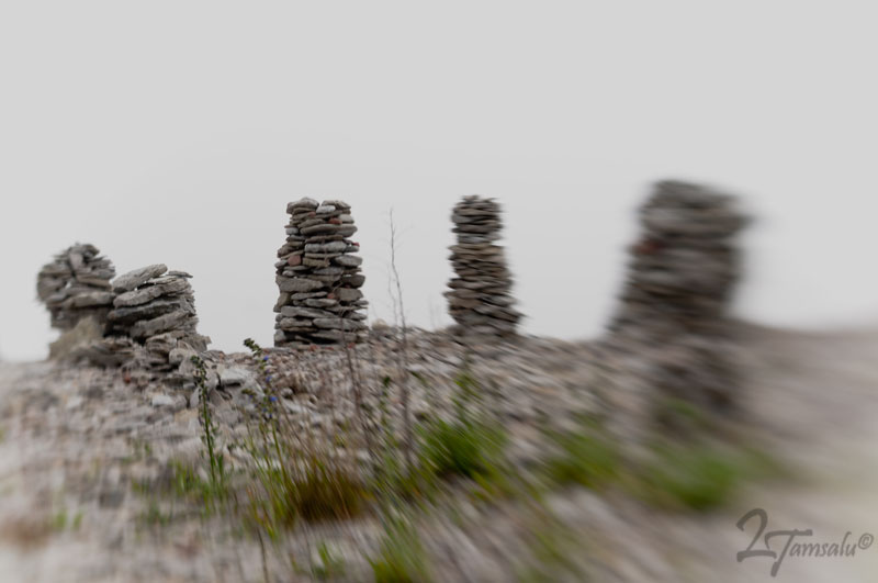
As we drove along we could not help but notice Flat Rock Beach: a pebbly beach where people stop and make towers of flat rocks. Anyone can stop here and build his own tower...


...or even an arch.


It is amazing that no one destroys this masterpieces but time...


This unusual place with thick fog inspired me to make an artistic version of Flat Rocks Beach.


The fog and the rocks were so appealing that one could not help but grab a camera and start shooting.


Our friend photographer Alexander Kladov was even brave enough to put on fishing rubber overall and plunge in the sea along with his tripod.


Soon he disappeared in the fog.


Luckily he came back: we did not want to lose a friend and face an international diplomatic scandal at the same time :)


Soon he was out but the beach still had plenty rocks to make your towers of.


A cool spot to update your social status, isn't it?


Soon we arrived to Ohessaare: we knew there was a small coffee shop located next to a windmill - tuulik. Coffe shop home-made bread, syrup, pickles, desserts (we especially recommend a delicious lime-green cake!), as well as accommodation inside the windmill. Even though there is no bathroom, its beautiful location right on the coast and exotic two-levels room right inside the windmill could make up for this incovenience. More information on Ohessaare windmill  website.


Another material used to make fences on Saaremaa is fishing net


Unique Saaremaa climate makes even flowers that can be found in other parts of Estonian grow in abundance.


Narrow bumpy roads brought us to Harilaid on the North-Western tip of the island. It is another narrow peninsula declared National park with sandy beaches on both sides. The landscape reminded us of sandy dunes of Kuronian Spit in Lithuania.


Driving back we made a stop at Virve sadam - do not be alarmed if you see the word "sadam" on the road signs, it only means "port" in Estonian.


At Virve port

At Virve port


The last stop before we headed back to ferry was at Panga pank - Panga cliff (also called Mustjala cliff) - on the Northern coast of the island. It is the highest of the Saaremaa and Muhu cliffs, reaching a height of 20 meters.
The entire cliff is approximately 2.5 km long, but next to Panga village there is a well-equipped viewpoint not only offering great views but also locally smoked freshly-caught fish and local draft beer - cloudy, but delicious.


At Panga cliff

Forest at Panga cliff
From Panga we headed straight to causeway leading to Muhu. We only had one stop before embarking on the ferry - at the ancient village of Koguva on Muhu island... Make sure you read part II!